Dilapidation
A dated, measurable baseline of neighbouring property and existing site conditions before work begins.

 Byron Bay to Gold Coast delivery partnership
Byron Bay Drone and KYBOS combine licensed aerial capture with high-accuracy 3D site documentation—giving architects, consultants, builders and owners a permanent, measurable record at every stage that matters.
One coordinated team for aerial photogrammetry, ground-based 3D scanning, interactive walkthroughs and usable project data from Byron Bay and the Northern Rivers through Tweed to the Gold Coast.
Construction moves quickly. Each capture locks in the evidence before concrete, plaster or handover closes the stage.
A dated, measurable baseline of neighbouring property and existing site conditions before work begins.
In-slab services, penetrations and set-out documented before the pour makes them inaccessible.
Framing, plumbing and electrical captured before walls close—available for future measurement.
An objective record at practical completion, supporting rectification and warranty discussions.
Registered spatial data and Revit/IFC models for renovation, design and consultant coordination.
Orthomosaics, progress imagery, roof geometry and site context captured by a CASA-licensed pilot.
These examples show how the team turns a site visit into clear, shareable evidence for builders, consultants and owners.
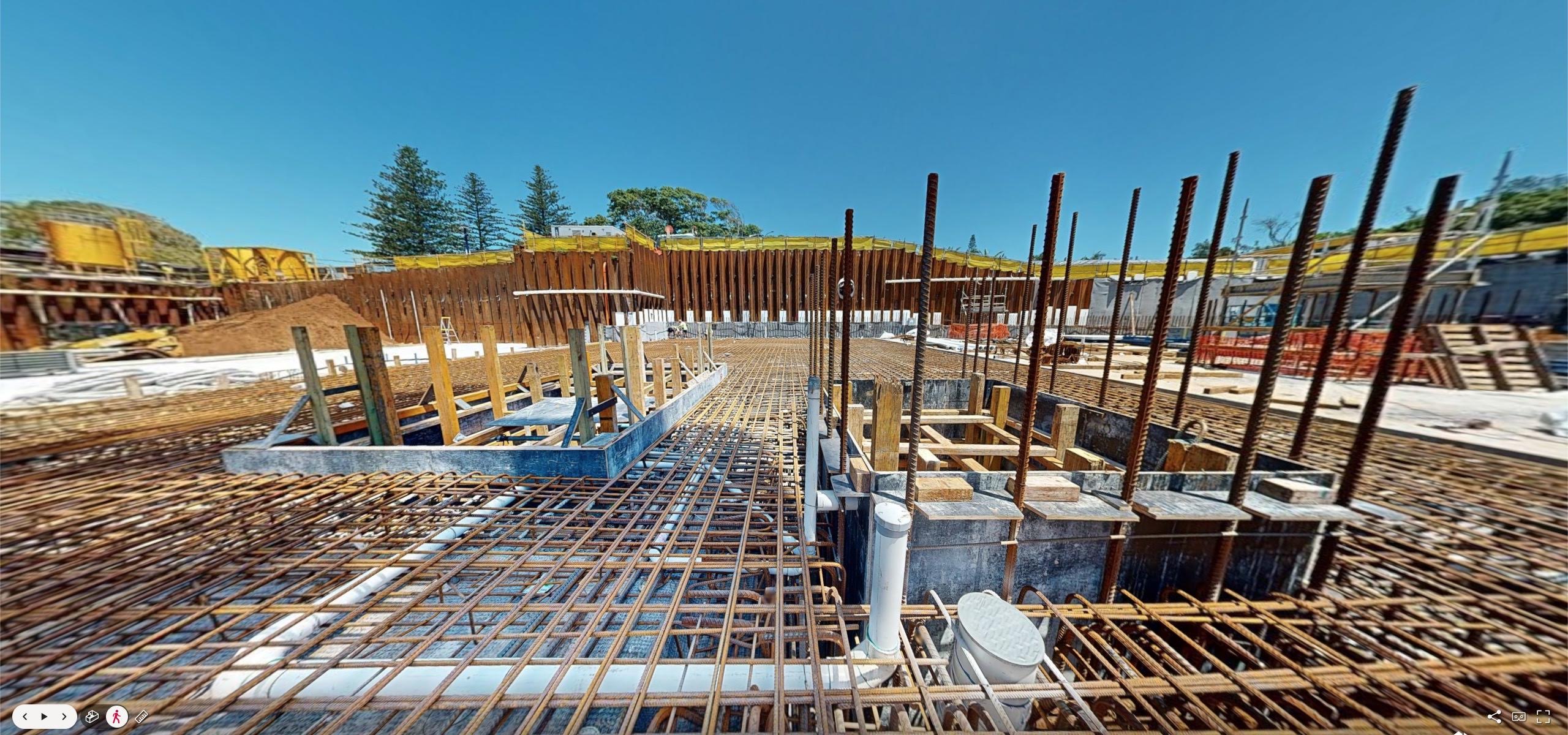
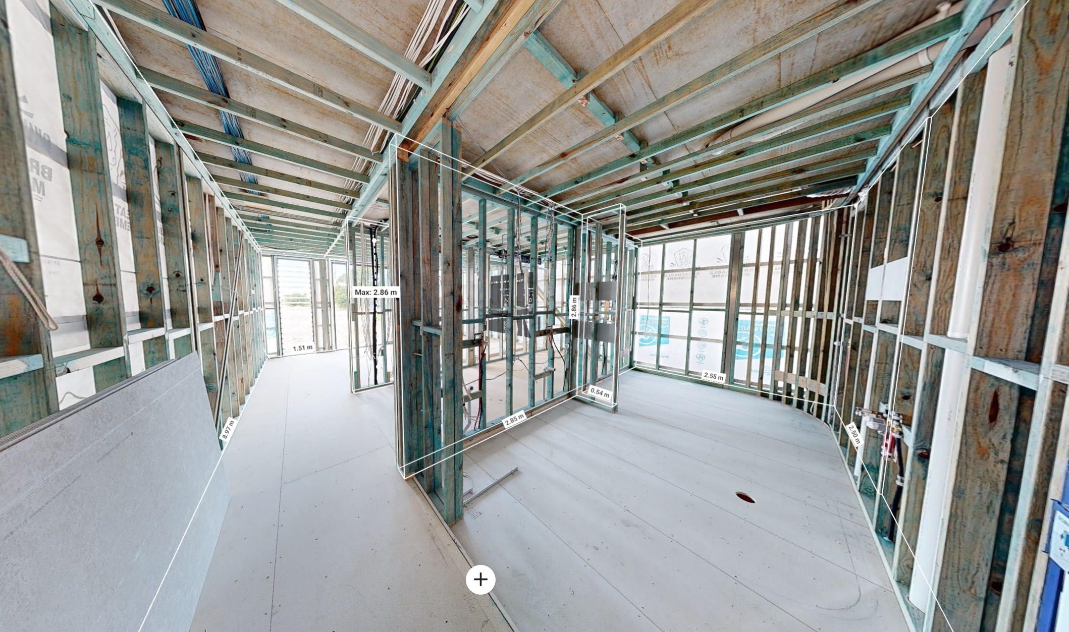
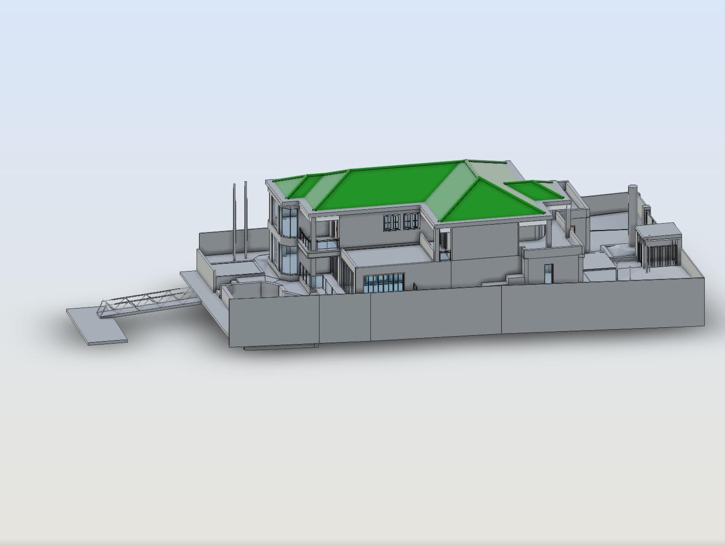
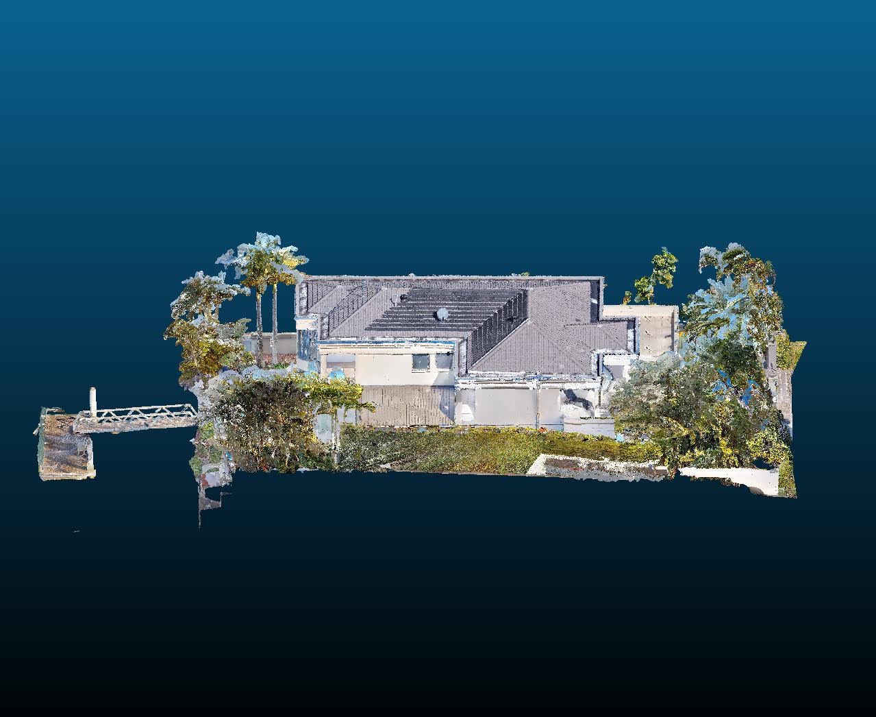
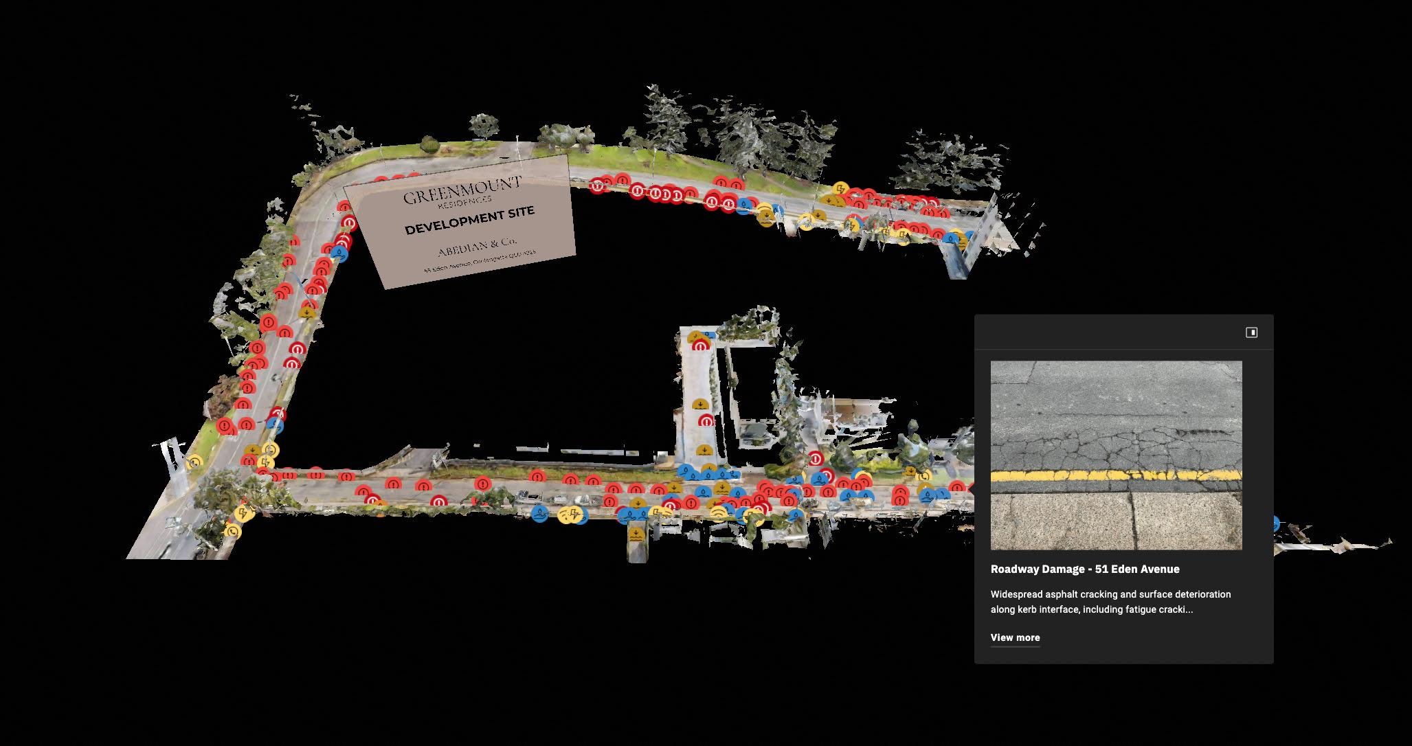
Explore a browser-based 3D site record and see how teams can review, measure and share a captured stage remotely.
A capture is useful only when it answers the next question. Deliverables are scoped around your project team and workflow.
Tell us the site, stage, access window and the decisions your team needs the capture to support.
We coordinate drone and ground scanning around the works, usually without shutting down the site.
Your team receives a browser-accessible record, plus spatial or modelling files specified in the brief.
Send the site address and construction milestone. We’ll respond with the recommended capture and quote.